NoeHill Travels in California
Historic Sites and Points of Interest in Inyo County
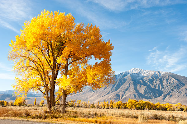
 Cottonwood Trees in Round Valley Near the Town of Bishop
3 November 2012
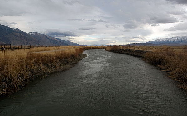
 Owens River Near the Town of Independence
18 February 2007
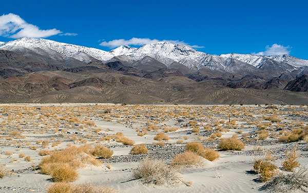
 Owens Lake South of the Town of Lone Pine
18 February 2007
(Click Photos To Zoom)
| Name | Address | City | Year | Authority | ID | Sort Address | Sort Name |
|---|---|---|---|---|---|---|---|
| San Francis Ranch | State Route 168 Near Red Hill Road | Bishop | 1861 | California | 208 | 168-1 | San Francis Ranch |
| Bend City | Mazourka Canyon Road | Independence | 1865 | California | 209 | Mazourka | Bend City |
| Mayfield Canyon Battleground | Ranger Station Road Northwest of Bishop | Bishop | 1862 | California | 211 | Ranger | Mayfield Canyon Battleground |
| Putnam's Cabin | 139 Edwards Street | Independence | 1861 | California | 223 | Edwards 139 | Putnam's Cabin |
| Austin Home | 253 Market Street | Independence | 1891 | California | 229 | Market 253 | Austin Home |
| Owensville | State Route 6 and Silver Canyon Road | Bishop | 1861 | California | 230 | 006-1 | Owensville |
| Camp Independence | Schabbell Lane | Independence | 1862 | California | 349 | Miller | Camp Independence |
| Burned Wagons Point | State Route 190 in Stovepipe Wells | Death Valley National Park | 1849 | California | 441 | 190-4 | Burned Wagons Point |
| Death Valley Gateway | State Route 190 and Badwater Road | Death Valley National Park | 1849 | California | 442 | 190-7 | Death Valley Gateway |
| Valley Wells | Trona Wildrose Road at Valley Wells Road | Trona | 1849 | California | 443 | Trona Wildrose | Valley Wells |
| Bennett-Arcane Long Camp | West Side Road | Death Valley National Park | 1849 | California | 444 | West Side | Bennett-Arcane Long Camp |
| Earthquake Victims Grave | US 395 South of Pangborne Lane | Lone Pine | 1872 | California | 507 | 395-5 | Earthquake Victims Grave |
| Cottonwood Charcoal Kilns | One Mile East of US 395 (Milepost 44.5) | Cartago | 1873 | California | 537 | 395-7 | Cottonwood Charcoal Kilns |
| Owens Lake Silver-Lead Furnace | State Route 136 | Swansea | 1869 | California | 752 | 136-2 | Owens Lake Silver-Lead Furnace |
| Harmony Borax Works | State Route 190 at Mustard Canyon Drive | Death Valley National Park | 1882 | California | 773 | 190-5 | Harmony Borax Works |
| Farley's Olancha Mill Site | US 395 at Fall Road | Olancha | 1862 | California | 796 | 395-8 | Farley's Olancha Mill Site |
| Bishop Creek Battleground | State Route 168 and Bishop Creek Road | Bishop | 1862 | California | 811 | 168-2 | Bishop Creek Battleground |
| Old Stovepipe Wells | Stovepipe Wells Road | Death Valley National Park | California | 826 | Stovepipe Wells | Old Stovepipe Wells | |
| Eichbaum Toll Road | State Route 190 in Stovepipe Wells Village | Death Valley National Park | 1926 | California | 848 | 190-3 | Eichbaum Toll Road |
| Japanese-American Relocation Center | US 395 (Milepost 67.3) | Manzanar National Historic Site | 1942 | California | 850 | 395-3 | Japanese-American Relocation Center |
| Laws Narrow Gauge Railroad Station | Silver Canyon Road at Joe Smith Road | Bishop | 1883 | California | 953 | Silver Canyon | Laws Narrow Gauge Railroad Station |
| Eagle Borax Works | West Side Road at Eagle Borax Well Road | Death Valley National Park | 1882 | National | 1974000338 | West Side | Eagle Borax Works |
| Harmony Borax Works | State Route 190 (Milepost 109.1) | Death Valley National Park | 1882 | National | 1974000339 | 190-5 | Harmony Borax Works |
| Skidoo | Wildrose Road at Skidoo Road | Death Valley National Park | National | 1974000349 | Wildrose | Skidoo | |
| Saline Valley Salt Tram | Swansea - Cerro Gordo Road | Inyo Mountains | 1911 | National | 1974000514 | Swansea | Saline Valley Salt Tram |
| Leadfield | Titus Canyon Road | Death Valley National Park | National | 1975000221 | Titus | Leadfield | |
| Japanese-American Relocation Center | US 395 Six Miles South of Independence | Manzanar National Historic Site | 1942 | National | 1976000484 | 395-3 | Japanese-American Relocation Center |
| Death Valley Scotty Historic District | North Highway | Death Valley National Park | National | 1978000297 | North Highway | Death Valley Scotty Historic District | |
| Death Valley Junction Historic District | State Route 190 and Highway 127 | Death Valley Junction | 1907 | National | 1980000802 | 190-8 | Death Valley Junction Historic District |
| Laws Railroad | Silver Canyon Road at Joe Smith Road | Bishop | 1883 | National | 1981000149 | Silver Canyon | Laws Railroad |
| Inyo County Courthouse | 168 North Edwards Street | Independence | 1921 | National | 1997001664 | Edwards 168 | Inyo County Courthouse |
| Adobe Wall | US 395 Between Bush and Mountain View | Lone Pine | POI | 395-3 | Adobe Wall | ||
| Aguereberry Point | Aguereberry Point Road | Death Valley National Park | POI | Aguereberry Point | Aguereberry Point | ||
| Alabama Gates | US 395 | Lone Pine | 1913 | POI | 395-5 | Alabama Gates | |
| Alabama Gates Marker | US 395 at Los Angeles Aqueduct Road | Lone Pine | 1913 | POI | 395-4 | Alabama Gates Marker | |
| Artists Drive | Artists Drive | Death Valley National Park | POI | Artists Drive | Artists Drive | ||
| Ashford Mill | Badwater Road | Death Valley National Park | POI | Badwater | Ashford Mill | ||
| Badwater Basin | Badwater Road | Death Valley National Park | POI | Badwater | Badwater Basin | ||
| Ballarat | Ballarat Road | Mojave Desert | POI | Ballarat | Ballarat | ||
| Ballarat Markers | Trona Wildrose Road at Ballarat Road | Mojave Desert | POI | Trona Wildrose | Ballarat Markers | ||
| Big Pine Canyon | Glacier Lodge Road | Inyo National Forest | POI | Glacier Lodge | Big Pine Canyon | ||
| Buttermilk Country | Buttermilk Road | Inyo National Forest | POI | Buttermilk | Buttermilk Country | ||
| Cardinal Gold Mine | Cardinal Road | Inyo National Forest | POI | 168-4 | Cardinal Gold Mine | ||
| Cerro Gordo | Cerro Gordo Road | Inyo Mountains | 1865 | POI | Cerro Gordo | Cerro Gordo | |
| Dantes View | Dantes View Road | Death Valley National Park | POI | Dantes View | Dantes View | ||
| Darwin | Darwin Road | Darwin | POI | Darwin | Darwin | ||
| Darwin Marker | State Route 190 and Darwin Road | Darwin | 1860 | POI | 190-1 | Darwin Marker | |
| Devils Golf Course | Devils Golf Course Road | Death Valley National Park | POI | Devils Golf Course | Devils Golf Course | ||
| Dolomite Mine | State Route 136 | Dolomite | 1883 | POI | 136-1 | Dolomite Mine | |
| Edwards House | West Market at Mary Alley | Independence | 1865 | POI | Market | Edwards House | |
| End of the Line | Malone Street | Keeler | 1883 | POI | Malone | End of the Line | |
| Engine #18 | Washington Street at Highway 395 | Independence | POI | Washington | Engine #18 | ||
| Father Crowley Vista | SR 190 | Death Valley National Park | POI | 190-10 | Father Crowley Vista | ||
| Furnace Creek Ranch | State Route 190 and Furnace Creek Boulevard | Death Valley National Park | POI | 190-6 | Furnace Creek Ranch | ||
| Gunga Din Historic Plaque | Horseshoe Meadow Road | Lone Pine | POI | Horseshoe Meadow | Gunga Din Historic Plaque | ||
| Keane Wonder Mine | Keane Wonder Road | Death Valley National Park | POI | Keane Wonder | Keane Wonder Mine | ||
| Kearsarge Station | Citrus Road at Powerline Road | Independence | 1866 | POI | Citrus | Kearsarge Station | |
| Kittie Lee Inn | North Main Street and East Pine Street | Bishop | 1924 | POI | Main | Kittie Lee Inn | |
| Klare Spring | Titus Canyon Road | Death Valley National Park | POI | Titus | Klare Spring | ||
| Lone Pine Film History Museum | 701 South Main Street | Lone Pine | POI | Main S 0701 | Lone Pine Film History Museum | ||
| Lone Pine Pioneer Cemetery | Sub Station Road East of Esha Street | Lone Pine | 1865 | POI | Sub Station | Lone Pine Pioneer Cemetery | |
| Lynching of the Convicts | US 395 South of Sawmill Road | Bishop | 1871 | POI | 395-2 | Lynching of the Convicts | |
| McKellips Grave | SR 190 | Mojave Desert | 1876 | POI | 190-10 | McKellips Grave | |
| Mesquite Flat Sand Dunes | SR 190 | Death Valley National Park | POI | 190-10 | Mesquite Flat Sand Dunes | ||
| Movie Flats | Whitney Portal Road at Movie Road | Lone Pine | POI | Whitney Portal | Movie Flats | ||
| Mule | Coats Street in the Tri-County Fairgrounds | Bishop | POI | Coats | Mule | ||
| Old Dinah | State Route 190 at Furnace Creek Ranch | Death Valley National Park | 1894 | POI | 190 | Old Dinah | |
| Owens Lake Dust Mitigation | State Route 136 | Keeler | POI | 136-3 | Owens Lake Dust Mitigation | ||
| Panamint City Marker | Trona Wildrose Road at Ballarat Road | Mojave Desert | 1872 | POI | Trona Wildrose | Panamint City Marker | |
| Pine Creek Mine | US 395 North of Gorge Road | Bishop | 1916 | POI | 395-1 | Pine Creek Mine | |
| Power for the Diggins | State Route 168 Near Cataract Road | Inyo National Forest | POI | 168-3 | Power for the Diggins | ||
| Round Valley | Pine Creek Road | Inyo National Forest | POI | Pine Creek | Round Valley | ||
| Salt Creek | Salt Creek Road | Death Valley National Park | POI | Salt Creek | Salt Creek | ||
| Schulman Grove | White Mountain Road | Inyo National Forest | POI | White Mountain | Schulman Grove | ||
| Shorty Harris Grave | West Side Road | Death Valley National Park | 1934 | POI | West Side | Shorty Harris Grave | |
| Titus Canyon Road | Titus Canyon Road | Death Valley National Park | POI | Titus Canyon | Titus Canyon Road | ||
| Twenty Mule Team Canyon | Twenty Mule Team Road | Death Valley National Park | POI | Twenty Mule Team | Twenty Mule Team Canyon | ||
| Wagon Wheel History | Scotty's Castle Road South of Stovepipe Wells Road | Death Valley National Park | 1906 | POI | Scotty's | Wagon Wheel History | |
| Westgaard Pass Toll Road | State Route 168 East of US 395 | Big Pine | POI | 168-5 | Westgaard Pass Toll Road | ||
| White Mountain City | Wyman Creek Road Near Route 168 | White Mountain City | POI | Wyman Creek | White Mountain City | ||
| Whitney Portal | Whitney Portal Road | Sequoia National Forest | POI | Whitney Portal | Whitney Portal | ||
| Wildrose Charcoal Kilns | Mahogany Flat Road | Death Valley National Park | 1879 | POI | Mahogany Flat | Wildrose Charcoal Kilns | |
| Winnedumah Hotel | 211 North Edwards Street | Independence | POI | Edwards N 0211 | Winnedumah Hotel | ||
| Zabriskie Point | SR 190 | Death Valley National Park | POI | 190-10 | Zabriskie Point | ||
| Zurich Station | State Route 168 East of the Owens River | Big Pine | 1884 | POI | 168-6 | Zurich Station |